Wells to Monuments Project Proposal - Phase 1

Wells to Monuments Program

Phase 1 Proposal

Purpose and Justification

Picture19.png

Introduction

The underlying concept for the Wells to Monuments Program was conceived by Dr. Elizabeth McDade of Chinn-McDade Associates, LLC.  Dr. McDade is also a co-author of the TranSET study referenced here.  This proposal is made by the group of collaborators listed below.  The intent of the program is to repurpose orphaned oil and gas wells to be used as geodetic monuments equipped with Global Navigation Satellite System (GNSS) equipment in a manner consistent with protocols of the U.S. National Geodetic Survey.  The most prevalent GNSS is the Global Positioning System (GPS) is a U.S.-owned utility that provides users with positioning, navigation, and timing (PNT) services.  It may also be possible that these monuments could be attached to corner reflectors design to reflect radar signals from an interferometric synthetic aperture radar (InSAR) satellite.  Geodetic monuments provide a survey base for the state and support mapping, boundary determination, property delineation, infrastructure development, resource evaluation surveys and scientific applications.  In addition, monuments equipped with GPS and/or InSAR reflectors allow for the measurement of vertical and horizontal velocities of the Earth’s surface to which the monument is anchored.  Orphaned oil and gas wells generally consist of steel casing that is anchored many thousands of feet below the surface.  This means that monuments created from repurposed wells will measure velocities that are not impacted by near-surface compaction (e.g., Keogh and Törnqvist, 2019).  The ability to compare vertical and horizontal velocities between new deep-anchored, as well as existing shallow-anchored GNSS and tide gauge monuments would provide new insights that both increase the spatial resolution of coastal monitoring, but that also enable separation of shallow and deep contributions to coastal subsidence (vertical velocity) and all forms of infrastructure design and planning, which may be impacted by both vertical and horizontal velocities.  Spatial patterns in the new data may also enable quantification of slow creep along coastal fault systems.

Picture1.png

Collaborators

Ahmed Abdalla

Assistant Professor Research, LSU Center for GeoInformatics

Reda M. Amer

Adjunct Professor, Tulane University School of Science & Engineering

Asst. Professor, GIS Remote Sensing Director, Lamar University


Mark Byrnes

Principal Coastal Scientist, Applied Coastal Research and Engineering, Inc.


J. Anthony Cavell

Surveyor, LSU Center for GeoInformatics


Cynthia J. Ebinger

Marshall-Heape Chair Professor, Tulane University School of Science & Engineering


Jeffrey Freymueller

Endowed Chair for Geology of the Solid Earth,  Michigan State University Department of Earth and


Karen Luttrell

Associate Professor, LSU Department of Geology & Geophysics


Chris McLindon

Geologist, McLindon Geosciences, LLC


Cliff Mugnier

Chief of Geodesy, LSU Center for GeoInformatics


Randy L. Osborne

Network Manager, LSU Center for GeoInformatics


Diana Carolina Hurtado Pulido

Ph.D. Candidate, Tulane University, School of Science & Engineering


The Wells to Monuments Program Proposal consists of four phases:

1.       Purpose and Justification

2.       Engineering Design and Cost Estimation

3.       Bureaucratic Procedure

4.       Implementation

This document is Phase 1 of the program proposal.  It is intended to outline the scientific purpose and justification for the program, and it will be followed by separate documents that define the subsequent phases.  Increasing the density of geodetic monuments in Louisiana is considered to have implicit value beyond the scientific purposes discussed here.  Louisiana currently has relatively sparse coverage of monuments in the National Geodetic Survey CORS (Continually Operating Reference Station) program.  The State of North Carolina, by comparison, has made a substantial investment in its network of geodetic monuments, and has much more robust coverage.  The benefits of the increased density of coverage in Louisiana that would result from the implementation of this proposed program extend to all phases of infrastructure design and planning including transportation, navigation, ports and coastal restoration.

Picture20.png

In addition to providing measurements of subsidence and enhancing positioning applications, other useful information can be extracted from the GPS signals. For the wells that are located over open water, reflectometry techniques can be applied to estimate the height of the GPS antenna above the water surface from the GPS receiver’s recorded signal to noise ratio, effectively turning the GPS site into a tide gauge (e.g., Larson et al., 2013; Larson et al., 2017; Larson, 2019). In addition, all of the sites may be usable to estimate precipitable water vapor (PWV) from the atmospheric delays on the GPS signals (Bevis et al., 1992; Bevis et al., 1994; Moore et al., 2015; Shuanggen et al., 2015). PWV observations from GPS (e.g., https://www.suominet.ucar.edu) have been incorporated in improved weather forecasts, and have been used to study severe weather events and intense rainfall events (e.g., Basivi et al., 2015; Sapucci et al., 2018).

It is the intention of this proposal that the data generated by the monuments created through its implementation should be open access.  This offers the opportunity to build on current in-state data collection that is managed by the LSU Center for GeoInformatics.

Proposed Wells

Six wells were chosen from the Louisiana Department of Natural Resources (DNR) Orphaned Well Program for consideration in the proposal.  The selection of these wells was based on three factors:  1) a distribution of locations that would effectively increase the density of geodetic monuments in the coastal zone, 2) locations that are likely to provide a range of velocity signals based on subsurface geology, and 3) the utility of the well in the program based on the conditions of the well and associated infrastructure at the surface.  The wells are shown here referenced by their American Petroleum Institute (API) well serial number, which is a unique identifier for each well, and to which all records of the well are referenced.  The well locations are shown in context to the existing CORS network.

According to the DNR program the term “orphaned” refers to the current status of a particular well site and indicates that the operator of record is no longer a viable responsible party.  Following a specific notification procedure, well sites are declared officially orphaned after being sent to the State Register to be published.  Wells are removed from the Orphaned Well Program through the Louisiana Oilfield Site Restoration Program, which was created in 1993. The focus of the program is to properly plug and abandon orphaned wells, and to restore the site to approximate pre-well site conditions by cutting well casing below the surface and removing all surface facilities and infrastructure associated with the well.  Revenue for the Oilfield Site Restoration Program is generated from a fee on oil and gas production in the state which is paid quarterly by Louisiana oil and gas operators.  The fund has collected on average about $4.5 million each year.  The program has plugged and abandoned and restored 2306 wells since 1993 at a cost of $64 million.  There are currently 2833 wells remaining in the program.  The intention of this proposal is to use funds from the Oilfield Site Restoration Program to properly plug and abandon each well below the surface but to leave the well head and surface infrastructure in place to be repurposed as a deeply-anchored geodetic monument.

Subsidence

The primary objective of this proposal is to provide new infrastructure for the direct measurement of subsidence velocities in the Louisiana coastal zone.  The National Academies Consensus Study Report (2018) recognized subsidence as an essential research gap in understanding the long-term evolution of the coastal system “The causes, rates, and patterns of subsidence along the Gulf Coast are not sufficiently well understood to allow for accurate prediction at the local to regional scale.”  The reasons for this insufficiency are both a paucity of subsidence measurement infrastructure and a poor comprehension of the relative contribution of the various causal processes.  According to the most recent study of subsidence published by the Louisiana Coastal Protection and Restoration Authority (Byrnes et al, 2019) “Understanding the causes and rates of subsidence is critical to successful planning and implementation for Louisiana Coastal Master Plan Projects”.  The study recognized that subsidence measured at the earth’s surface is the result of natural causes such as the consolidation of Holocene, Pleistocene, and Tertiary age sediments, fault-induced elevation changes due to basin tectonics, and down-warping of the underlying lithosphere due to sediment loading, and human-induced causes such as lowering the groundwater table, overburden associated with flood protection levees, and marsh settling due to altered hydrology.  Other studies have recognized Glacial Isostatic Adjustment (GIA) as a contributing cause of subsidence (Love et al, 2016).  Some of these processes are rooted in geological processes that are happening deep within the earth, such as down-warping of the lithosphere, and some are rooted in very shallow processes, such as near-surface consolidation.  The study found that previous attributions of deep-seated geologic processes as the primary mechanisms of subsidence measured at the surface by Dokka (2006,2011) assumed that all measured elevation changes reflected movement deeper than the base of piling or rods.  Byrnes et al found that unanchored and/or unsleeved benchmark rods or pilings in Holocene sediment are affected by the downward force exerted by the consolidating deltaic sediment.

Keogh and Törnqvist (2019) highlighted the importance of understanding the depth at which benchmark monuments are anchored.  Tide gauges, which have been are the primary source of data used to calculate multi-decadal- to century-scale rates of relative sea-level change, are each associated with an elevation benchmark.   Keogh and Törnqvist showed that depth at which these monuments are anchored varies substantially across the coast relative to the top of the Pleistocene surface.  Holocene sediments above this surface are highly compactable.

Picture21.png

Using deeply anchored wells as monuments would provide a true direct measurement of subsidence velocities that are not affected by the consolidation of Holocene deltaic sediments.  This proposal recommends that each deeply-anchored monument created from a repurposed well should be co-located with a shallow-anchored monument.  Each of these monuments could be equipped with both a GPS device and an InSAR corner reflector.  This configuration would allow for the most accurate assessment of subsidence signals.

Picture22.png

Horizontal velocities

These figures from Karegar et al (2015) show values of vertical and horizontal velocities measured by CORS stations across Louisiana.  The inset in the graph on the left shows the relationship between vertical velocities and the thickness of Holocene sediments, as measured by Kulp (2000).  Byrnes et al (2019) similarly found that the spatial variability in subsidence has a “compelling relationship” with the thickness of Holocene deltaic deposits.  Karegar et al state that the horizontal velocities in the graph on the right “may reflect slow downslope movement on a series of listric normal faults due to gravitational sliding but could also represent the horizontal component of differential compaction”.  Velocity data collected from deeply-anchored monuments could provide valuable insights into horzontal motion in coastal Louisiana.  This vector of land motion is rarely considered in infrastructure design and planning.

Picture2.png

Subsurface Geology

Every significant recent study of vertical and horizontal land motion in coastal Louisiana (Byrnes et al, 2019; Dokka et al (2006); Jones et al (2016); Karegar et al (2015); Zou et al (2015)) has recognized the potential contribution of fault slip.  However, there has been limited access to accurate maps of subsurface fault planes or surface fault traces.  The first accurate map of surface fault traces in coastal Louisiana was published by Armstrong et al (2014).  Researchers  at  Tulane  and UT-Austin used an oil and gas industry 3-D  seismic survey in Plaquemines Parish to project the surface traces of about 20 faults.  Since then, on-going work by research groups at Tulane, UNO and ULL have significantly expanded the coverage of surface fault trace interpretation using seismic data.  This research has been funded in part by grants from the U.S. Department of Transportation’s University Transportation Centers Program and through the Louisiana CPRA Center of Excellence Research Grants Program (the RESTORE Act) administered by The Water Institute of the Gulf.  Preliminary interpretations have been published by the Transportation Consortium of South Central States (Culpepper et al, 2019), and are available in GIS form on the LA Department of Transportation Website.  These published interpretations have been integrated here with unpublished interpretations by McLindon Geosciences that are the result of subsurface geological interpretation in coastal Louisiana utilizing seismic and well log data over the past 40 years.  The surface fault trace maps presented here follow the color scheme used by Armstrong et al and are considered to be the most comprehensive and accurate interpretations available.

Picture3.png

These maps illustrate the strong relationship between vertical velocities measured by existing monuments and the thickness of Holocene deltaic sediments from Kulp (2000) that was noted by Karegar et al (2015) and Byrnes et al (2019).  It is important to recognize, however, that the axis of maximum thickness of the Holocene coincides with that of the regional geological feature commonly called the Terrebonne Trough.  Maximum Holocene thickness lies between sets of conjugate faults that form the northern and southern boundaries of the trough.  Progressive fault slip throughout the Holocene could have contributed to the increased thickness of the Holocene along this axis.  Recent fault movement could be contributing to the subsidence velocities that may otherwise appear to be solely dependent on Holocene thickness.  Deeply-anchored monuments could provide data that could help to differentiate the relative contributions of these two factors.  Horizontal velocities of the CORS sites reported by Karegar et al (2015) appear to be consistent with expected fault movement based on these interpretations.  If the horizontal velocities were entirely due to a horizontal component of compaction, the station at Grand Isle should measure a more northerly vector of motion, toward the center of the compacting basin.

The CORS network and the proposed wells are shown in context to stations in the Coastwide Reference Monitoring System (CRMS), which is operated by CPRA and USGS.  CRMS has collected a wealth of valuable data over the past two decades.  A typical station measures vertical sediment accretion, surface elevation change, land area change and soil salinity.  Currently, the highly accurate surface elevation change data does not record measurements relative to a fixed datum like sea level.  Elevation change measurements are made relative to a fixed Rod Surface Elevation Table (RSET), which is probably subsiding at an unknown rate.  An increased density of geodetic monuments among the CRMS stations would improve the estimations of subsidence rate at each RSET and would thereby allow for a more accurate estimation of the surface elevation change relative to sea level.  Eventually InSAR corner reflectors may be attached to the RSET at CRMS stations and calibrated to nearby geodetic monuments.  A direct measurement of subsidence rates at CRMS stations would allow for detailed evaluation of the relationships between accretion, subsidence and land area change.  Many CRMS stations that are measuring high sediment accretion rates are also measuring net gains in land area.  It is likely that the rate of accretion is greater than the rate of relative sea level rise (subsidence plus eustatic sea level rise) in these areas.

The geological interpretations presented here indicate that the horizontal vectors of land motion in coastal Louisiana are primarily affected by movement associated with the network of faults and salt features including salt domes and salt welds.  Hedec and Jackson (2011) modified the genetic block diagram from Rowan (1999), which shows the relationships among these features.  Schuster (1995) mapped outlines of the ridges of salt bodies that parallel the coast and the directions of horizontal movement along the salt welds (evacuated allochthonous salt).  The implied vectors of horizontal motion are consistent with those being measured by the existing geodetic monuments.  The increased density of monuments provided by the proposed program would allow for a more detailed understanding of these relationships.

Picture17a.png

Geological overview of proposed well locations

Three of the proposed well locations are shown in relationship to the surface fault traces published by Culpepper et al (2019).  Subsurface depth contours of the associated salt domes are shown in green.  These locations offer a range of settings relative to the subsurface geology that are likely to produce a range of land motion velocity signals.  The higher vertical velocities should be expected at wells 170578814100 to the south, which is near the center axis of the Terrebonne Trough and well 170572144800 which is in the Golden Meadow graben.  Well 170572297200 is north of the bounding faults of the trough and adjacent to the Clovelly salt dome.  This location should measure lower vertical velocity than those to the south.  It may also measure some component of velocity that is influenced by the dome, which rises to less than 400 feet below the surface.  Research in this area continues at Tulane with the addition of a 3-D seismic survey to the south.  Future publications resulting from this research should significantly expand the scope and detail of geological interpretations in this area.  The addition of land motion data from these proposed locations would offer a significant enhancement to understanding the results of the ongoing geological research.  The ultimate goal is to better understand relationships between subsurface geological processes and surface morphological and ecological processes.

Picture4.png

These three proposed locations are shown in relationship to surface fault traces and salt domes mapped by McLindon Geosciences.  A portion of these fault traces are included in the publication by Armstrong et al (2014).  The eventual publication of ongoing research at UNO will provide more detailed interpretation of faults in this area.  Maximum land motion velocities values would be expected from well 170750164600 to the south, which is anchored on the hanging wall block of the Bastian Bay fault.  The lowest values would be expected from well 1707523036200 to the north, which is on the footwall block of the Ironton fault.  Well 170512090000 in the center is in a complex location involving the Barataria fault, the Lake Five fault and the Bay de Chene salt dome and would be expected to produce intermediate velocity values.  Each of these locations will be considered in the context of more detailed geological interpretations in the pdf version of the full proposal document.

Picture5.png

Well 170750164600 is of particular interest because of its proximity to Pete Hebert’s camp. Gagliano et al (2003) collected anecdotal evidence of subsidence from local oyster fishermen and camp owners.  Pete Hebert that told Gagliano about his camp built in the 1960s in Plaquemines Parish west of Buras.  The camp was located on the banks of Bayou Ferrand, but by the mid-1970s it was standing in open water.  Hebert reported that the land surface under the camp sank by 3 to 3 ½ feet over that time span.  Gagliano later referred to the Bastian Bay fault as the “Rosetta Stone” for deciphering relationships among fault movement, subsidence and land loss in southeast Louisiana.  Subsequent scientific investigations of the Bastian Bay fault using seismic data were conducted by Armstrong et al (2014) and Dawers and Martin (2006).  The episode of fault movement implied by the rapid sinking of Pete Hebert’s camp would coincide with the formation of the Fort St. Phillip crevasse during the 1973 flood.  It may be the case that the crevasse was caused by the fault movement.  Historical crevasses at Darrow, Vacherie and Davis Pond appear to be associated with faults.  It may also be the case that movement on the fault during a major flood event was not coincidental.  The dilation of shallow aquifers during high river stages is likely to change the stress field across the surface and may contribute to triggering fault slip.  Episodic fault movement would be likely to produce variable velocity signals from a monument in this location.

Picture6.png
Slide1.PNG
Slide2.PNG

Summary and Conclusions

The Wells to Monuments Program offers an opportunity to significantly increase the density of geodetic monuments in the Louisiana coastal zone by making use of existing infrastructure that would otherwise incur costs to be removed.  The array of proposed well locations offers several sites that appear to be well suited for the co-location of deep- and shallow-anchored monuments that could make use of both GPS and InSAR technologies.  Collecting velocity data from locations that were specifically chosen for the geologic setting is the most expedient way to determine the relationships between subsurface geological features and land motion at the surface – and ultimately between subsurface geology and surface coastal processes.


References

Akintomide, A. O. and Dawers, N. H., 2019, Spatial and Temporal Variation of Fault Activity in the Terrebonne Salt Withdrawal Basin, Southeastern Louisiana: Response to Salt Evacuation and Sediment Loading, presentation, AAPG Annual Meeting, San Antonio, Texas.

Armstrong, C., Mohrig, D., Hess, T., George, T., Straub, K.M.,  2014, Influence of growth faults on coastal fluvial systems: Examples from the late Miocene to Recent Mississippi River Delta, Sedimentary Geology, v. 301, p. 120-132

Basivi, R., Fabry, F., Braun, J. J., & Vanhove, T. M. (2015). Precipitable water from GPS over the continental United States: Diurnal cycle, intercomparisons with NARR, and link with convective initiation. Journal Of Climate, 28, 2584-2599. doi:10.1175/JCLI-D-14-00366.1

Bevis, M., S. Businger, T. A. Herring, C. Rocken, R. A. Anthes, and R. H. Ware, 1992: GPS meteorology: Remote sensing of atmospheric water vapor using the Global Positioning System. J. Geophys. Res., 97, 15 787–15 801, doi:10.1029/92JD01517.

Bevis, M., S. Businger , S. Chiswell, T. A. Herring, R. Anthes, C. Rocken, and R. H. Ware, 1994: GPS meteorology: Mapping zenith wet delays onto precipitable water. J. Appl. Meteor., 33, 379–386, doi:10.1175/1520-0450(1994)033,0379:GMMZWD.2.0.CO;2.

Bullock, J. S., Kulp, M. A., McLindon, C. D., 2018, Evaluation of the Magnolia growth fault, Plaquemines Parish, southeastern Louisiana, poster session, GSA Annual Meeting, Indianapolis, Indiana.

Byrnes, M. R., Britsch, L. D., Burlinghoff, J. L., Johnson, R., Khalil, S., 2019, Recent Subsidence rates for Barataria Basin, Louisiana, Geo-Marine Letters, 14 p. doi.org/10.1007/s00367-019-00573-3.

Byrnes, M. R., Britsch, L. D., Burlinghoff, J. L., Johnson, R., Khalil, S., 2019. Determining Recent Subsidence Rates for Breton Sound and Eastern Pontchartrain Basins, Louisiana: Implications for Engineering and Design of Coastal Restoration Projects. Final Report prepared for Louisiana Coastal Protection and Restoration Authority. Contract 4400009020, Task 8, 58 p.

Culpepper, D., E.C. McDade, N. Dawers, M. Kulp, R. Zhang, 2019, Synthesis of Fault Traces in SE Louisiana Relative to Infrastructure, Transportation Consortium of South-Central States, Project No. 17GTLSU 12, 54 p.

Dixon, T.H., Amelung, F., Ferretti, A., Novali, F., Rocca, F., Dokka, R., Sella, G., Sang-Wan, K., Wdowinski, S., Whitman, D., 2006, Subsidence and flooding in New Orleans, Nature, v. 441, p. 587-588

Dawers, N.H. and E. Martin. 2005. Fault-related changes in Louisiana coastal geometry, Louisiana Governor’s Applied Coastal Research and Development Program, GACRDP Technical Report Series 05-000, 21 p.

Dokka, R.K., 2006, Modern-day tectonic subsidence in coastal Louisiana, Geology, v. 34, p. 281-284.

Dokka, R. K., G. Sella, and T. H. Dixon, 2006, Tectonic control of subsidence and southward displacement of southeast Louisiana with respect to stable North America, Geophys. Res. Lett., 33, L23308, 5 p.

Dokka, R.K., 2011, The role of deep processes in late 20th century subsidence of New Orleans and coastal areas of southern Louisiana and Mississippi, Journal of Geophysical Research, v. 116, 25 p.

Frank, J. P., 2017, Evidence of fault movement during the Holocene in Southern Louisiana: integrating 3-D seismic data with shallow high resolution seismic data, MS Thesis, University of New Orleans, 91 p.

Gagliano, S.M., Kemp III, E. B., Wicker, K. M., Wiltenmuth, K. S., Sabate, R. W., 2003 Neo-Tectonic Framework of Southeast Louisiana and Applications to Coastal Restoration, Transactions G.C.A.G.S., v. 53, p. 262-272

Gagliano, S.M., Kemp III, E. B., Wicker, K. M., Wiltenmuth, K. S., 2003. Active Geological Faults and Land Change in Southeastern Louisiana. Prepared for U.S. Army Corps of Engineers, New Orleans District, Contract No. DACW 29-00-C-0034.

Gagliano, S.M., et.al., 2005, Effects of Earthquakes, Fault Movements, and Subsidence on the South Louisiana Landscape, The Louisiana Civil Engineer Journal of the Louisiana Section of The American Society of Civil Engineers Baton Rouge, Louisiana Volume 13, Number 2, pp. 5-7, 19-22

Hopkins, M., Lopez, J., Songy, A. 2018, Subsidence rates from faulting determined by real-time kinematic (RTK) elevation surveys of bridges in Lake Pontchartrain,  presentation, State of the Coast Conference 2018, New Orleans, Louisiana.

Hudec, M. R. and M.P.A. Jackson, 2011, The Salt Mine, AAPG Memoir 95, 305 p.

Ivins, E.R., Dokka, R.K., Blom, R.G., 2007, Post-glacial sediment load and subsidence in coastal Louisiana, Geophysical Research Letters, v. 34, L16303, 5 p.

Johnston, A., Zhang, R., Gottardi, R., Dawers, N. H., 2017, Investigating the relationships between tectonics and land loss near Golden Meadow, Louisiana by utilizing 3-D seismic and well log data, poster session, GSA Annual Meeting, Seattle, Washington.

Jones, C.E., An, K., Blom, R.G., Kent, J.D., Ivins, E.R., and Bekaert, D., 2016, Anthropogenic and geologic influences on subsidence in the vicinity of New Orleans, Louisiana, Journal of Geophysical Research: Solid Earth, v. 121, DOI: 10.1002/2015JB012636.

Karegar, M.A., Dixon, T.H., Malservisi, R., 2015, A three-dimensional surface velocity field for the Mississippi River Delta: Implications for coastal restoration and flood potential, Geology, v. 43, p. 519-522

Keogh, M. and T. Törnqvist, 2019, Measuring rates of present-day relative sea-level rise in low-elevation coastal zones:  a critical evaluation, Ocean Science, 15, 61-73.

Kulp M. 2000. Holocene stratigraphy, history, and subsidence of the Mississippi River delta region, north-central Gulf of Mexico. PhD thesis. Univ. Kentucky, Lexington. 283 pp.

Larson, K. M., R. D. Ray, F. G. Nievinski, and J. T. Freymueller, The Accidental Tide Gauge: A GPS Reflections Case Study from Kachemak Bay, Alaska, IEEE GRSL, Vol 10(5), 1200-1204, doi:10.1109/LGRS.2012.2236075, 2013.

Larson, K.M., R. Ray, and S.P. Williams, A ten-year comparison of water levels measured with a geodetic GPS receiver versus a conventional tide gauge, J. Atmos. Ocean Tech., Vol. 34(2), 295-307, doi:10.1175/JTECH-D-16-0101.1, 2017.

Larson, K.M. Unanticipated Uses of the Global Positioning System, Annual Rev. Earth and Planet. Sci., Vol. 47, 19-40, doi:10.1146/annurev-earth-053018-060203, 2019.

Levesh, J. L,, Kulp, M. A., McLindon, C. D., 2019, Fault-slip history of the Delacroix Island fault system and its effect on Holocene salt marshes of the Mississippi River delta plain,  presentation, GSA Annual Meeting, Charleston, South Carolina

Love, R., Milne, G.A., Tarasov, L., Engelhart, S.E., Hijma, M.P., Latychev, K., Horton, B.P. and Törnqvist, T.E., 2016. The contribution of glacial isostatic adjustment to projections of sea‐level change along the Atlantic and Gulf coasts of North America. Earth's Future, 4(10), pp.440-464.

McLindon, C.D., 2017, History of fault slip and interaction with deltaic deposition from the middle Miocene to the Present – Barataria fault, coastal Louisiana, poster session, American Geophysical Union, annual meeting, New Orleans, Louisiana.

Meckel, T. A. 2008, An attempt to reconcile subsidence rates determined from various techniques in southern Louisiana, Quaternary Science Review, v. 27, p. 1517–1522

Moore, A., Small, I., Gutman, S., Bock, Y., Dumas, J., Fang, P., Haase, J., Jackson, M.and Laber, J. (2015) National Weather Service Forecasters use GPS precipitable water vapor for enhanced situational awareness during the Southern California Summer Monsoon. Bulletin of the American Meteorological Society, 96, 1867–1877.

National Academies of Sciences, Engineering, and Medicine. 2018, Understanding the Long-term Evolution of the Coupled Natural-Human Coastal System. The Future of the U.S. Gulf Coast: Washington, DC: The National Academies Press. doi: 10.17226/25108

Rowan, M.G., M.P.A. Jackson and B.D. Trudgill, 1999, Salt-Related Fault Families and Fault Welds in the Northern Gulf of Mexico, AAPG Bulletin v. 83 no. 9, p. 1454-84

Schuster, D. C., 1995, Deformation of Allochthonous Salt and Evolution of Salt-Structural Systems, Eastern Louisiana Gulf Coast, in M.P.A. Jackson, D.G. Roberts, and S. Snelson, eds., Salt Tectonics: a global perspective AAPG Memoir 65, p. 177-198

Shinkle, K. D., and R. K. Dokka, 2004, Rates of vertical displacement at benchmarks in the Lower Mississippi Valley and the northern Gulf Coast, NOAA Tech. Rep. 50

Sapucci LF, Machado LAT, de Souza EM, Campos TB. Global Positioning System precipitable water vapour (GPS-PWV) jumps before intense rain events: A potential application to nowcasting. Meteorol Appl. 2019;26:49–63. https:// doi.org/10.1002/met.1735

Shangguan, M., Heise, S., Bender, M., Dick, G., Ramatschi, M. and Wickert, J. (2015) Validation of GPS atmospheric water vapor with WVR data in satellite tracking mode. Annales de Geophysique, 33, 55–61.

Zou, L., Kent, J., Lam, N. S.-N., Cai, H., Qjang, Y., and Li, K., 2016, Evaluating Land Subsidence Rates and Their Implications for Land Loss in the Lower Mississippi River B


The Bastian Bay fault

AdamsBayCamp2.jpg

The best inputs to a scientific investigation always come from the people in the field.  Woody Gagliano spent many years in the marshes of coastal Louisiana studying the patterns of change.  He collected scientific data, but also spoke to the local oyster fishermen and camp owners.  It was Pete Hebert that told Gagliano about his camp built in the 1960s in Plaquemines Parish west of Buras.  The camp was located on the banks of Bayou Ferrand, but by the mid-1970s it was standing in open water.  Hebert reported that the land surface under the camp sank by 3 to 3 ½ feet over that time span.  Gagliano realized that the submergence of Hebert’s camp was due to movement on the Bastian Bay fault, which he had found by constructing profiles of the shallow subsurface from auger borings.  Gagliano later referred to the Bastian Bay fault as the “Rosetta Stone” for deciphering relationships among fault movement, subsidence and land loss in southeast Louisiana.  Subsequent scientific investigation of the Bastian Bay fault by geologists at Tulane and the University of Texas at Austin confirmed the location of the fault using seismic data (Armstrong et al, 2013; Dawers and Martin, 2006)

Camp1.PNG
Camp2.PNG

The Bastian Bay fault is near the eastern end of the Terrebonne Trough.  The fault is one of a series of down-to-the-south faults (highlighted in blue) that bound the northern rim of the trough.  They appear to have a conjugate relationship with a set of northern-dipping faults (highlighted in red) and salt domes that bound the southern rim.  Miocene, Pliocene and Quaternary sedimentary layers are all thicker within the trough, and the weight differential created by these thick piles of sediment appears to have driven subsidence and fault movement for at least the past 15 million years. 

Regional map.png

Most of the major faults bounding the Terrebonne Trough appear to extend to the surface where recent fault movement has played a critical role in causing wetlands loss.  The figure below shows the subsurface depth contours of the Bastian Bay fault plane in yellow and their connection to the Lake Washington salt dome shown in green.  The zero-depth contour coincides with the surface trace of the Bastian Bay fault.  Similar fault plane contour maps for each of the other faults that reach the surface could be constructed using seismic data and well logs. 

Contours2.PNG

Like most of the other faults along the Terrebonne Trough, the Bastian Bay fault controlled the formation of geological structures at depth.  Most of these structures control the accumulation of oil and gas in the Miocene, Pliocene and Pleistocene sands.  Bastian Bay Field is an example of a “rollover fault structure” in which an anticlinal structure is created by the thickening of sedimentary layers into the fault at the time of deposition.   At Bastian Bay Field the producing gas reservoirs are found in sand layers that were deposited by ancestral deltas of the Mississippi River during the upper Miocene.  The subsurface structure map on the “O” Sand published by the New Orleans Geological Society shows the concentric contours of the anticlinal structure, which has a crest at depth of 12,400 feet below the surface.  The red area indicates the extent of gas accumulation at the top of the rollover structure.  The Bastian Bay fault runs along the northern edge of the anticline and forms a boundary of the gas reservoir.  A small synthetic fault running parallel to the Bastian Bay fault forms the southern boundary of this gas reservoir.  Wells drilled to a depth of 12,400 feet or greater within the red area encountered gas in the “O” Sand.

OSandMap.png

A cross section of well logs from the field shows the arrangement of the fault and the producing gas reservoirs.  The “throw” of the fault at any horizon is the difference in elevation across the fault.  At the upper blue Miocene horizon the throw is about 1,500 feet.  At the “X” Sand the throw is over 3,000 feet.  The interval thickness between each of the labeled sand layers is greater on the downthrown (or hanging wall) side of the fault than it is on the upthrown (or footwall) side.  This indicates continuous fault movement during the deposition of the deltaic sands, and it is why faults like this are referred to as “growth faults”.  

CrossSection.png

A simplified model for the history of the Bastian Bay fault can be constructed by isolating the fault in a depositional sequence in which all other faults and salt domes have been removed and sedimentary layers are considered to be flat and continuous away from the fault.  The reality is that the complex arrangement of structural features in the subsurface have all been interacting with each other throughout the deposition of the sedimentary layers, but this is very difficult to model.

BlockDiagram1.png

The Bastian Bay fault probably began as slide structure on the lower continental slope during the lower Miocene.   A study of the mechanics of faults by geologists W. Crans, G. Mandl and J. Harembore at Shell Research Laboratory found that when loose sediment is deposited on a gently inclined slope (about 3 degrees), its weight has a surface-parallel component that tends to pull it down the slope.  As long as this force is balanced by the reactive shear stress along the slope, the sediment will stay on the slope in stable equilibrium.  As sedimentation continues and the height of the sediment layer increases, both the “pulling” weight component and the reactive shear stress increase proportionally.  The equilibrium will remain stable as long as the slope-parallel shear stress remains below the limit determined by the shear strength of the sediment.

The shear strength of the sediment may be reduced when pore fluids become “geopressured” meaning that they support a portion of the overburden.  The greater the magnitude of geopressure, the lower the shear strength of the sediments.  At a critical point when the driving weight component exceeds the friction along the base of a sedimentary layer it may begin to slide along the basal slip plane.  In this model the initial lateral slip of the fault results in a negative vertical component of slip in the active plastic region at the head of the fault and a positive vertical component in the passive plastic region at the toe of the fault.  The accommodation capacity created at the head of the fault allows for a differential accumulation of sediment on the hanging wall of the fault, which will continue to drive fault movement in a feedback loop.

CransDiagram.png
BlockDiagram2.png

The influx of terrigenous sediments into the Terrebonne Trough during the middle Miocene triggered episodes of dramatic fault movement on all of the bounding faults including the Bastian Bay fault.  It is significant to note that these faults tended to act as an interconnected system of faults throughout this time.  It is probable that a triggering event on one fault could result movement that rippled throughout the system.  The simplified model on the Bastian Bay fault during this period shows that the original lateral slip plane of the fault begins to arc upward to a steeper angle.  This is the result of more competent normally pressured sediments. The curving arc of the fault plane defines the nature of a listric fault.  The model also shows that fluids migrate along the fault plane, including hydrocarbons.  It is almost certain that the gas accumulated in the Miocene reservoirs at Bastian Bay Field migrated up the Bastian Bay fault and into the sand layers at some time after their deposition. 

BlockDiagram3.png

Movement on the Bastian Bay fault continued to propagate throughout the Pliocene and the Quaternary.  The movement of fluids up the fault plane continued throughout this time period and into the present.  It is probable that saline fluids reach the surface along these major faults.  This may be responsible for some of the salinity anomalies that have been measured in the coastal wetlands (Keucher et al, 2001).

BlockDiagram4.png

A subsurface structure map on the top of the Pliocene stratigraphic interval shows the trace of the Bastian Bay fault.  The fault trace is constructed on this map by marking the intersection of the depth of the mapped horizon and the depth of the fault plane.  In the vicinity of the Bastian Bay Field the top of the Pliocene horizon is at a depth of about 2350 feet on the hanging wall and about 2250 feet on the footwall.  The two sides of the fault trace on the map are coincident with the equivalent 2350-foot and 2250-foot contours on the fault plane map.  This means that the throw of the fault in this area at the top of the Pliocene is about 100 feet.  Because the elevation of the surface in south Louisiana is effectively zero, a map on the depth of the top of the Pliocene is also a map of the thickness of the Quaternary (the Pleistocene and the Holocene).  The Quaternary is therefore 100 feet thicker on the downthrown side of the Bastian Bay fault than it is on the upthrown sides.  This indicates that the fault continued to be active in the Quaternary, which generally qualifies it as an “active fault”. 

Contours1.PNG

A detailed well log cross section of the Quaternary across the Bastian Bay fault shows that the fault remained continually active throughout the interval.  Individual stratigraphic intervals in the Pleistocene are vertically offset by the fault and they are generally thicker on the hanging wall side than they are on the footwall side.  This pattern extends into a tentative interpretation of the base of the Holocene interval from well log correlation.  It is apparent from this interpretation that there is stratigraphic evidence that the Bastian Bay fault was active during the Holocene. It is probable that late Holocene activity on the fault would have been associated with the deposition of sediments in the Bayou Robinson delta lobe between 950 and 300 years ago (Kulp et al, 2005).  Bayou Ferrand was originally formed as a distributary channel in this delta lobe.

QuaternaryProfile.png

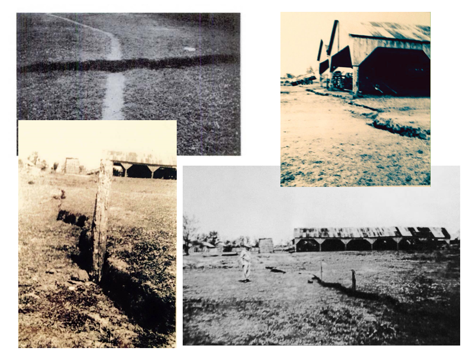
Gagliano realized that the submergence of the marshes around Pete Hebert’s camp was a result of the latest episode of movement on the Bastian Bay fault.  It is the nature of all faults to move episodically in (geologically) short bursts of activity.  In the tectonic regions of California these episodes are generally very brief, and fault slip happens dramatically in a matter of seconds.  In a delta system where the forces are all driven by the weight of the deltaic sediments fault slip can happen much more slowly and will generally not create a detectable seismic signal.  The most recent episode of fault slip on the Bastian Bay fault appears to have happened over a period of about a decade between the early 1970s and the early 1980s.  Imagery of the area taken from the ProPublica publication “Losing Ground” is used in this short video sequence to show the submergence of the marsh on the hanging wall side of the Bastian Bay fault during that time period.  The interconnected nature of the system of faults bounding the Terrebonne Trough throughout their geological history strongly suggests that similar patterns of movement happened on most of these faults during the same time period.  This is likely to be the principal cause of the episode of wetlands loss that occurred between the 1970s and 1980s in southeastern Louisiana.

REFERENCES

Armstrong, C., Mohrig, D., Hess, T., George, T., Straub, K.M., 2014, Influence of growth faults on coastal fluvial systems: Examples from the late Miocene to Recent Mississippi River Delta, Sedimentary Geology, v. 301, p. 120-132

Crans, W., Mandl, G., Haremboure, J., 1980, On the Theory of Growth Faulting: A Geomechanical Delta Model Based on Gravity Sliding, Journal of Petroleum Geology, v. 2, p. 265-307

Dawers, N. H. and Martin, E., 2006, Fault Related Changes in Louisiana Coastal Geometry, Louisiana Governor’s Applied Coastal Research and Development Program, GACRDP Technical Report Series 05-000, 21 p.

Gagliano, S.M., Kemp III, E. B., Wicker, K. M., Wiltenmuth, K. S., Sabate, R. W., 2003 Neo-Tectonic Framework of Southeast Louisiana and Applications to Coastal Restoration, Transactions G.C.A.G.S., v. 53, p. 262-272

Gagliano, S.M., Kemp III, E. B., Wicker, K. M., Wiltenmuth, K. S., 2003. Active Geological Faults and Land Change in Southeastern Louisiana. Prepared for U.S. Army Corps of Engineers, New Orleans District, Contract No. DACW 29-00-C-0034

Kulp, M. A., Fitzgerald, D., Penland, S., 2005, Sand-Rich Lithosomes of the Holocene Mississippi River Delta Plain, SEPM Special Publication No. 83, SEPM (Society for Sedimentary Geology), ISBN 1-56576-113-8, p. 279–293.